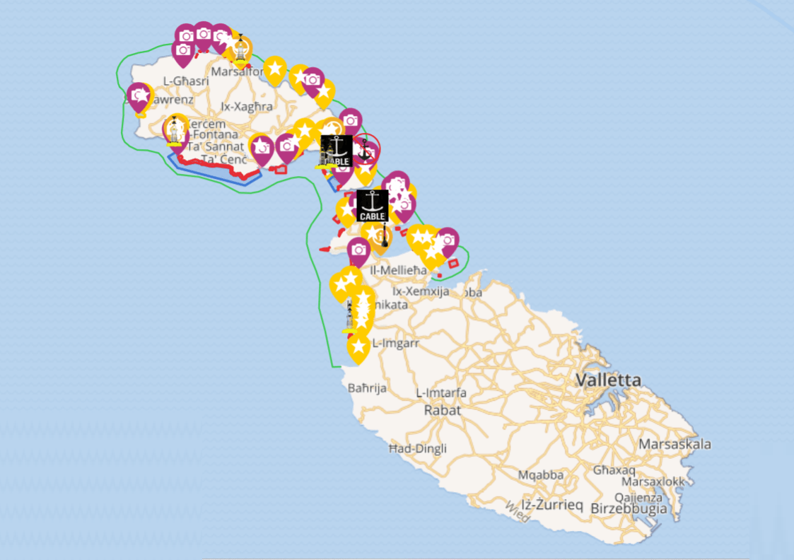
Discover Our Interactive Map: Your Smart Companion at Sea
Renting a boat to explore Malta, Gozo, and Comino is one of the most rewarding ways to discover the islands’ natural beauty. From crystal-clear lagoons to towering cliffs, secret caves, and historic watchtowers, the Maltese archipelago offers endless opportunities for adventure. But navigating these waters—especially if you’re unfamiliar with local regulations and marine hazards—can be a challenge.
That’s why we’ve developed our Interactive Navigation Map, a smart and user-friendly tool designed for boat rentals, to make your journey safer, easier, and more enjoyable. With just a quick scan of a QR code located onboard, you’ll gain instant access to an updated, GPS-assisted map of Malta, Gozo, and Comino—right from your phone or tablet.
Let’s take a look at what makes this tool so valuable for your next maritime adventure.
Why an Interactive Map Matters in the Maltese Islands
The coastal waters surrounding Malta, Gozo, and Comino are incredibly diverse—ranging from shallow sandy bays to deep rocky inlets, vibrant dive sites, protected marine reserves, and busy harbors. Many areas are subject to specific boating regulations, including speed limits, no-anchoring zones, and protected boundaries.
Our interactive map is your reliable, real-time guide that simplifies these complexities. Whether you’re cruising around Comino’s Blue Lagoon, anchoring off Gozo’s San Blas Bay, or navigating Malta’s west coast near Dingli Cliffs, this tool provides the information you need to stay safe, responsible, and within the rules.
What You'll Find on the Map
Designed with clarity and ease of use in mind, the map highlights everything relevant to navigation across the three islands:
🚫 Restricted and Regulated Zones
The map clearly marks:
Fish farms (especially common around central Malta)
No-anchoring areas, including zones protecting seabeds or submerged infrastructure
Areas where you must keep a minimum distance from cliffs, caves, and rocky shorelines
Speed-regulated zones, often near swimming areas or sensitive marine habitats
⚠️ Hazards at Sea
The Maltese coast is scattered with:
Shallow reefs and submerged rocks
Narrow inlets and rocky points (particularly in Gozo and around Comino’s coast)
Busy channels where extra caution is needed
All of these are flagged on the map, helping you steer clear of trouble before it becomes a problem.
🏊♂️ Swimming and Diving Zones
Especially around Comino and the northern coasts of Gozo and Malta, you’ll find well-marked swimming zones. These areas are off-limits to boats for safety reasons but are often great places to stop nearby and swim or snorkel in designated spots.
🛥️ Approved Navigation Area
Our rental boats are licensed to operate within a defined perimeter surrounding Malta, Gozo, and Comino. This boundary is clearly marked on the map, so you always know how far you can go and where you’re allowed to explore.
📍 GPS Location Tracking (with Refresh)
Using your mobile GPS, the map can pinpoint your location—so you can see where you are in relation to landmarks, zones, or hazards.
Note: The map does not support continuous live tracking. You’ll need to refresh the page to update your current position. While not ideal, we’re currently working with our service provider to implement live GPS updates in the near future.
Explore Iconic Coastal Spots Around the Islands
Aside from navigation support, the map offers an interactive way to discover some of the region’s most breathtaking coastal sights. You’ll find highlighted points of interest such as:
The Blue Lagoon (Comino)
Ramla Bay and San Blas Bay (Gozo)
Dwejra and Popeye Village
Historic towers, caves, and natural formations all around the islands
Each location comes with a short description, and tapping on the name with the more infor icon gives you extended historical and cultural insights. It’s like having a local guide right in your pocket.
How to Access the Map Onboard
Accessing the map couldn’t be easier:
Step aboard your vessel.
Scan the QR code displayed near the control panel.
The map will open in your mobile browser—no downloads or apps required.
Start navigating and exploring right away.
It works on both iOS and Android devices, and adapts well to different screen sizes.
Always Updated & Compliant with Transport Malta
We continuously update the map based on the latest maritime regulations from Transport Malta, including Notices to Mariners, seasonal rules, and environmental restrictions.
This ensures you’re always working with accurate, compliant information, giving you peace of mind throughout your journey.
Supporting Safe, Responsible Exploration
The Maltese archipelago is a delicate ecosystem. With thousands of visitors on the water each year, it’s more important than ever to navigate responsibly. Our interactive map supports this by giving you the tools to:
Respect protected areas
Avoid hazardous zones
Reduce environmental impact
Learn about and appreciate the coastline
When every client uses the map, we all contribute to sustainable marine tourism.
What’s Next? Improving GPS Functionality
We understand that manual location refresh isn’t ideal for everyone. That’s why we’re actively working with our service provider to enable real-time GPS tracking in a future update. Our goal is to offer the most seamless navigation experience possible.
Your feedback is welcome as we continue improving this tool.
Blue
AI Agent
Hello! I’m Blue from Bluewaves Watersports. Ask me anything about boat hire, jet skis or trips around Comino.